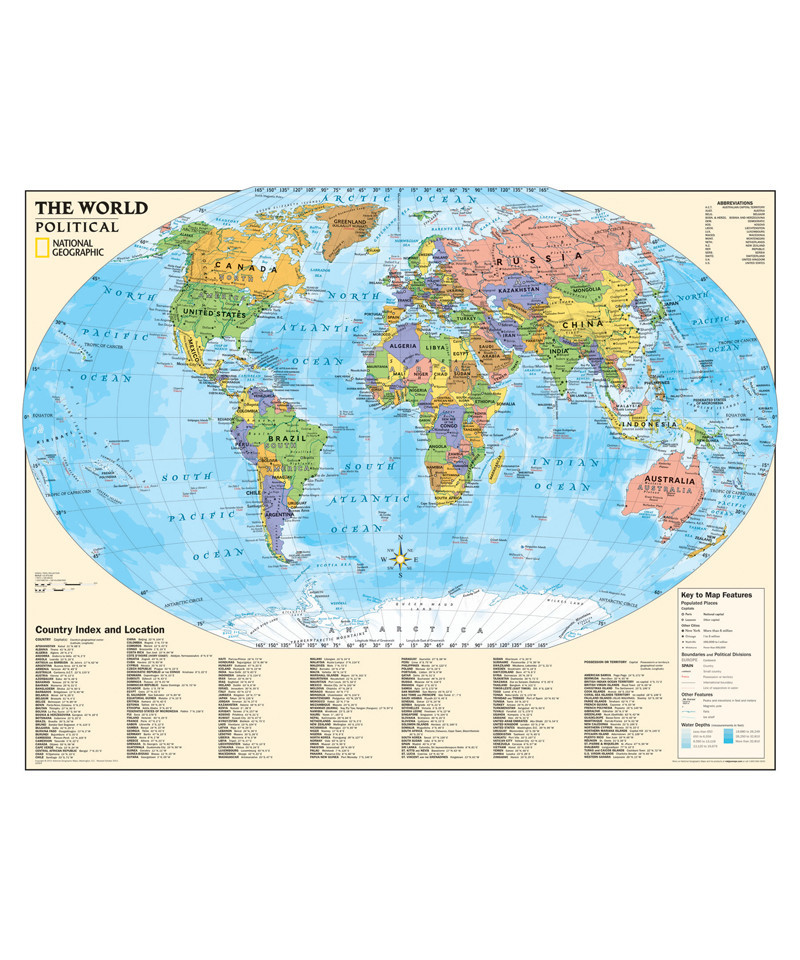
Introducing a new series of National Geographic maps designed specifically for kids. Our new graded-series of maps are the first to address the unique needs of K-12 students as they advance their understanding of our world.
Unlike other classroom poster maps, ours utilize the Winkel-Triple projection, which provides the best combination of size, shape, and distance giving students the best visual representation of the Earth's surface. This solves the effect seen on other maps where Greenland appears larger than South America.
Our Political Series, grades 4-12, includes an up-to-date world map with an increased level of detail and more information for students and teachers.