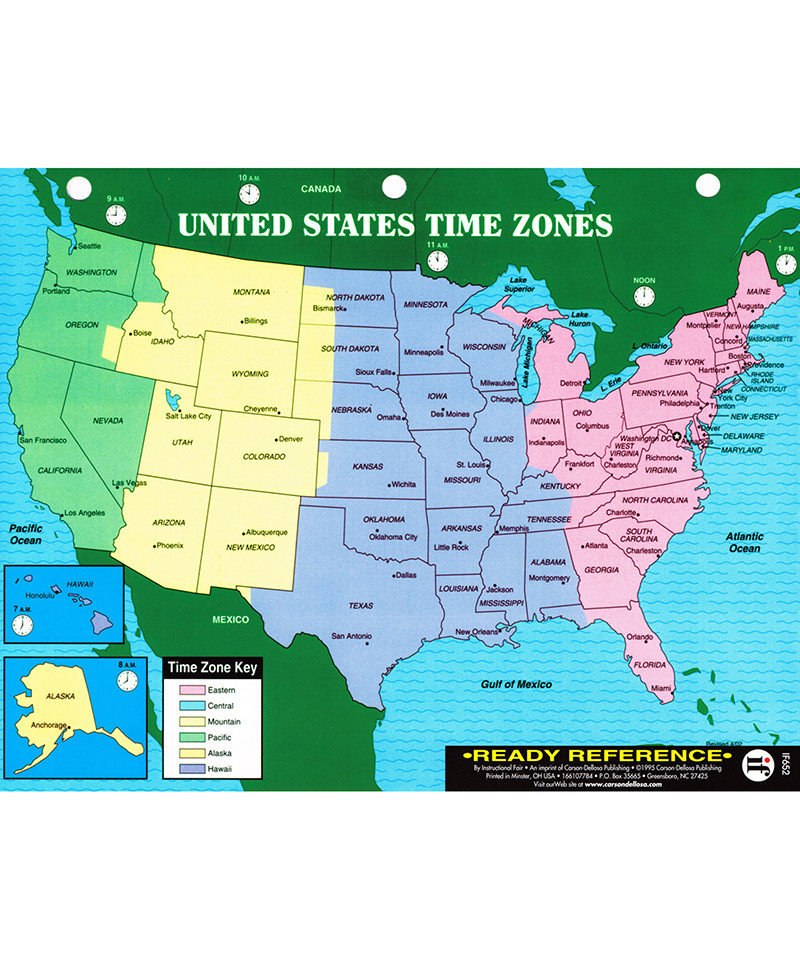
U.S. map includes state names and large cities, and is color-coded to show the different time zones. World map includes countries, oceans, time zones, and longitude and latitude lines. Students can keep all the facts right at their fingertips with this colorful two-sided ready reference card! Comes pre-punched for a three-ring binder and is laminated for years of use. 8 1/2" x 11" (22 x 28cm).