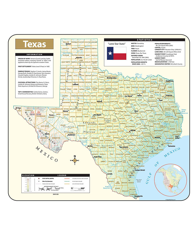
The Texas Shaded Relief Topographical Wall Map by Universal Map is full-color and laminated, making it durable, markable, and easy to read. Includes historical, anecdotal, and geographical information, an elevation scale measured in meters and feet, and a distance scale measured in miles and kilometers. Identifies county boundaries, state flag, motto, bird, flower, and tree, plus total area, population, and origin of name.